Friday, July 18, 2008

Maps for July 26 Big Sioux River cruise


overview
Originally uploaded by Iron Bieso
I'm posting an overview map of the cruise for July 26. Just a reminder, we'll start the cruise at noon and hope to get the shuttling of vehicles completed before that, so come early to get that wrangled.

I'm including images of the start and end points as well. Remember, you can click on these images and see them in a larger size. Also, using Google maps, you can dial in all the information you might need, don't forget to use their satellite, terrain, and map features together, it's what I do. E-mail me, Jarett Bies, at jbies0341@hotmail.com with any questions.


Ending

Start1

Monday, July 14, 2008

Wonderful scenery on tap Saturday, July 19


P5260011
Originally uploaded by Iron Bieso
Mary Finck of the SDCA board will host a cruise starting at 7 a.m., July 19, (this Saturday) starting at the Dell Rapids City Park and heading down the Big Sioux River to Baltic.

Mary said she has a few people already coming, but everyone is welcome to take part in this scenic, not-too-long trip on the Big Sioux.

As this picture shows, the Dells of the Big Sioux are splendid for photos. The trip will also take the rapids of the Dells, unless Mary is planning to skirt them or portage around them.

Water levels make those rapids pretty tame, and they last for only a few dozen meters before the river returns to its chug-chug tameness.

If you're an early riser and feel like paddling the river, join Mary and the gang in Dell Rapids. To reach the park, take the Dell Rapids exit off I-29, then travel east into town. At Garfield, take a right, you'll be in the park, the river runs right alongside it, and there's a nice gravel access point.

Email Jarett with questions, or Mary directly at MFinck@eggersteel.com.

Tuesday, July 8, 2008

News: Site change coming, more


IMG_0421
Originally uploaded by jayalbionheath
Larry Braaten has been on the Big Sioux River lately, and we're not going to take the Klondike to Canton route on July 26 due to debris.

Instead we'll reprise the route from the put-in shown here in this nice photo, located just north of Lake Alvin, and paddle down to the Klondike. Last year this was our biggest event, about 40 boats and 50 paddlers, and everyone had fun. Shuttle will be provided. It starts at noon, Saturday, July 26, 2008. E-mail Jarett with questions.

In other news, the father and son who lost boats but safely crawled from a BSR strainer are still fine, and now their boats are, too. Again, props to Larry for helping them track 'em down and get them back, he found one on a recent outing. That's what I call a good paddling community.

Don't forget to check out the post below, or hit Jay Heath's blog, http://southdakotakayak.blogspot.com/, for full details on Saturday's water monitoring operation at Grass Lake, just west of Sioux Falls.
It starts at 9 a.m. July 12.


On July 17 at 6 p.m., SDCA members, following Mary Finck's lead, will meet in Sioux Falls at the BSR access right off 26th Street East, near the 229 loop. Those who gather will sweep the banks (in the boats) and clean up trash.

Plans are in the works for the SDCA newletter to be out this week. Sorry for the delay, but this issue will cover June and July. We'll augment with a late-July mailing if we need to do so.

On the waters downstream front, we are scouting sites for a James River August cruise, and we'll post details as soon as they are solid.

In review: Saturday, 9 a.m., Grass Lake; Thursday, July 17, 6 p.m., Big Sioux clean-up in Sioux Falls; July 26 cruise starting point moved to Lake Alvin, ending point, Klondike; two chaps who lost their boats got 'em back.

Cheers,

Jarett

Grass Lake Monitoring Saturday, July 12

From http://southdakotakayak.blogspot.com/:

The SDCA in association with Dakota Water Watch, a water resource monitoring program of the East Dakota Water Development District, will participate in a bacteria monitoring project at Grass Lake on July 12, 2008. This will be a single event carried out to establish a base line of water bacteria levels linked to fecal material and disease-causing organisms. This event will involve collecting samples from 20 points around the lake for analysis in a “mini-lab.”

SDCA volunteers will gather at 9:00 a.m. at the Grass Lake public access point and receive training in the collection process and be provided some basic background information on the project. The training will last an hour or so, and the SDCA participants will then set out in their boats to collect samples from assigned points around the lake. The training, collection, and preparation of the samples will be lead by Jeanne Fromm, project manager for Dakota Water Watch.

After training, the SDCA participants will set out and collect their water samples. There will be enough time for kayaks to take a circuit of the lake if desired before returning with the samples. A complete circuit of the lake takes about an hour, although it is possible to spend a couple of hours checking out the islands, shoreline, and bird life. The participants will have their samples back at the “put-in” site sometime around 11:00 a.m. Jeanne Fromm will collect the samples as the boats return, and the SDCA participants will be able to help prepare the samples for analysis. That process takes only five minutes or so. The lab preparation will be done as boats return, so it should be possible for participants to finish their lap around the lake, drop off the samples, and have their assignment completed between 11:00 and 11:30 a.m.

The SDCA is participating in this project as a public service. It is also a good opportunity for members to get a closer look at how water analysis is completed. So, this project ought to offer a nice morning on Grass Lake, a chance to network with other SDCA members, and provide a feeling of contribution to environmental management.

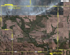
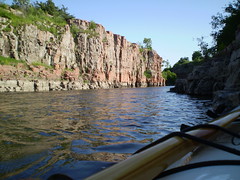
Grass Lake is a wonderful and secluded body of water in close proximity to Sioux Falls. There is a lot of bird life to observe, especially pelicans, great blue herons, geese, and ducks. Other wildlife is often seen along the shores, including muskrat, raccoon, and deer. From Sioux Falls, the lake is reached by going west on Highway 42 (12th Street) past the Wall Lake turnoff, on to 459th Street. At 459th Street, turn right and go north about 2.5 miles. The road enters into a curve around the east end of the lake after about two miles. On the left, there is a small white sign that identifies a gravel road leading into the public access area, located just a short distance along that entrance. The public access point is on the northeastern end of the lake. There is a “turn around” area and a very primitive launching point. No SD parks sticker is needed to use this site.

For this event, there are 20 samples to be collected, and there is activity for about 10 volunteers. We would like for people to “register” in advance so that we know that there will be enough, and that there will be an assignment for each boat. If you would like to participate on this 9:00 – 11:30 a.m. event on Saturday, July 12, please e-mail or call Jay Heath at jheath@sio.midco.net or 371-3622 by July 5. If there is any need to cancel the event, calls will be made to those registering.