
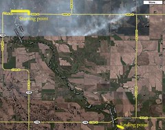
I'm including images of the start and end points as well. Remember, you can click on these images and see them in a larger size. Also, using Google maps, you can dial in all the information you might need, don't forget to use their satellite, terrain, and map features together, it's what I do. E-mail me, Jarett Bies, at jbies0341@hotmail.com with any questions.


No comments:
Post a Comment